
Behold the Power of Uninterrupted Descents
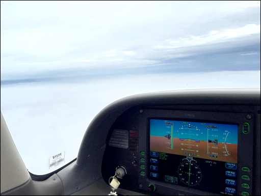
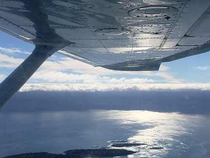
“Descend and maintain” is such a staple of IFR communications it might as well be a single word. Yet there are times when that’s the last thing you want to do. Maybe those clouds are bumpy and you have the family on board. Maybe they’re icy and you need to minimize your exposure. Maybe you just like the tailwinds where you are and want to keep them for as long as possible before you absolutely must descend to land.
For whatever reason, you don’t want to descend only to level off at some intermediate point. You want to descend later, or uninterrupted to a point below the area of concern.
It Never Hurts To Ask
Sometimes, ATC volunteers this kind of freedom with a clearance of, “… descend at pilot’s discretion, maintain 3000.” You hear this more often in the sparely populated spaces. However, you can certainly ask for the freedom. If ATC issues a descent you’d like to delay, reply with:
“Request descent at pilot’s discretion.”
You may get a crossing restriction, such as, “… descend at pilot’s discretion to 3000. Cross FIXIE at 3000.” If that works for you, terrific. If not, it’s time to negotiate.
Keep your request as clear as possible because you’re asking for something out of the ordinary.
“Approach, we’d like to remain at 6000 until we can get an uninterrupted descent to 2000 to minimize our time in the turbulent/icy/scary/icky (circle one) clouds.”
Be prepared to negotiate. “We can accept vectors off course if that helps. Thanks.” Remember that altitude changes have three primary purposes in the controller’s mind: To keep aircraft separated, to give you a reasonable transition onto the approach at your destination, and to meet local airspace procedures as to who controls which aircraft in which blocks of sky.
You and the controller may need to get creative to meet everyone’s needs. Freedom to not descend may cost you some time in a weird side vector. You may have to give in order to get.
Of course, if the situation warrants it, you can always use the E-word and get any altitude you need, but we’re trying to keep this low-key. Remember, the family is in the back.
There are a couple of other tools that we often forget about that can be helpful here. Asking for pilot’s discretion obviously works, but you can’t go back up once you vacate an altitude.
Let’s say you’re really not sure about those clouds 500 feet below you. Will they have ice in them or not? Getting a block altitude might be just what you need. If you were at 6000, you might request, “… 6000 block 4000 for about 10 miles …”
Once approved, you own all altitudes from 6000 down to 4000 and back up. Now you could dip your toe into the troubled altitude and see if it’s likely to be an issue. If not, great; you can convert your block altitude back into a solid IFR altitude and continue. If there is an issue, you can retreat back to 6000 and plan your next move.
The other tool is a cruise clearance. You won’t get one coming into White Plains, NY, but you can get them at low-traffic areas or hours. The beauty of the cruise clearance is that it is pilot’s discretion all the way to the pavement. If you request, “… cruise 6000,” and it’s approved, you can stay at 6000 as long as you want, even as you get established on a published approach.
You can go as low as the MEA or published minimum for any segment of the approach—and that’s any approach you want. You could even cruise to a point in the clear on a published route and then request a contact approach to stay out of the clouds to make it to the airport visually.
That’s the beauty of knowing what to ask for. Sometimes ATC couldn’t care less what altitude you fly, while for you it makes all the difference.
Watch This Video:
“Discretion on Descents”
Going Up Funny: Shuttle Climbs
Sometimes you want to climb in a specific way or over a specific place. When I lived in Seattle, we had a local procedure called a shuttle climb. The issue was that climbing eastbound over the rising terrain toward the mountains in winter might turn you into a flying Slurpee.
The solution was requesting a “Shuttle climb over Puget Sound.” This was a series of vectors, first north, then south, then back north again, and so on, until you broke out on top or felt comfortable turning east.
It was common to find no ice at all, or just a trace of rime, climbing over the Sound even when there were PIREPs of ice by the hills. You also had low, warmer terrain below in case you did find ice and had to turn tail back home.
ForeFlight Question of the Month:
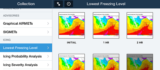
Most of the information about icing is found in the imagery section of ForeFlight. To find direct information about actual or predicted icing you should look in:
A. The Icing section of imagery. It’s all collected there.
B. Icing and G- AIRMETs/ SIGMETs
C. Icing, G-AIRMETs/ SIGMETs, and PIREPs.
D. Icing, G-AIRMETs/ SIGMETs, PIREPs, and relevant radar.