Subscriber question:
"Are TAFs a good source for identifying thunderstorms along a route?" - Frank N.
Scott:
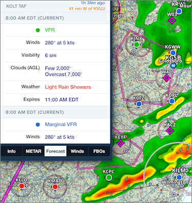
“Terminal Aerodrome Forecasts, better known as TAFs, have some important limitations especially when associated with forecasts for thunderstorms. Despite these limitations, it is very common for a pilot to use TAFs as if they were an area forecast. They simply bounce through all of the TAFs along their route of flight looking for a forecast for thunderstorms. We’ll see why this isn’t such a good idea for determining thunderstorm potential along your route.
 One of the first words that should come to mind when using a TAF is the word tiny. The terminal area is defined as the cylindrical volume of airspace from the center of the airport’s runway complex to a radius of five statute miles. It is basically like a forecast for a college campus.
Even the terminal area’s vicinity is also very small representing the donut-shaped ring ranging from 5 to 10 statute miles excluding the 5 statute mile terminal area. This includes a forecast for thunderstorms in the vicinity, showers in the vicinity or fog in the vicinity.
The moral is that TAFs are not intended to forecast weather beyond 10 statute miles; they are a point forecast and not a zone or area forecast. Therefore, it is not a good idea just to scan the TAFs and assume that the lack of a forecast for thunderstorms in the TAFs means an absence of thunderstorms enroute. The Area Forecast (and Graphical Forecasts for Aviation), on the other hand, will have an indication when pulse or air mass thunderstorms are possible even when the TAFs are indeed silent on the issue.
As a result, it is very common in the summer for terminal forecasts to be void of thunderstorms when the Area Forecast (and Graphical Forecasts for Aviation) has a clear indication of isolated or widely scattered thunderstorms.”
Note: Area Forecast will be retired soon, replaced with Graphical Forecasts for Aviation.

